Hawaiʻi's Marine Life Conservation Districts, usually shortened to MLCDs, are the closest thing the state has to underwater national parks. They are small, most of them are right off popular beaches, and inside them the fish behave differently: bigger, more numerous and noticeably less nervous of divers. They are also places where a casual habit from home, such as picking up a shell, feeding fish or anchoring on the reef, can be a violation of state rules.
This guide explains what the districts are, where they are, what the rules mean for a visiting diver or snorkeler and how to report a problem. It is written for divers, not fishers; if you plan to fish anywhere in Hawaiʻi, use the state's official fishing regulations.
- Managed by
- DLNR Division of Aquatic Resources
- Enforced by
- DLNR DOCARE officers
- First district
- Hanauma Bay, 1967
- Number
- Eleven, statewide
- Islands with none
- Kauaʻi, Molokaʻi
- Report a violation
- 643-DLNR or the DLNRTip app
What an MLCD Is
An MLCD is an area of ocean set aside by the state to conserve and replenish marine life. Each district has its own boundaries and its own section of the Hawaiʻi Administrative Rules, written by the Department of Land and Natural Resources (DLNR) and administered by its Division of Aquatic Resources. Hanauma Bay became the first in October 1967. Others followed over the next decades, and today there are eleven, from Pūpūkea on Oʻahu's North Shore to Kealakekua Bay on the Kona coast.
MLCDs are one type of protected area among several. The state also has fisheries management areas with targeted rules (Maui's Kahekili area off Kāʻanapali protects plant-eating fish such as parrotfish and surgeonfish), natural area reserves managed by a different DLNR division, and federal protections that apply everywhere, such as those for sea turtles, monk seals, humpback whales and spinner dolphins. An MLCD is the strictest of the state's common marine designations for the average visitor, and the one you are most likely to swim into without realizing it.
The Eleven Districts
| District | Island | What to know | Used by divers for |
|---|---|---|---|
| Hanauma Bay | Oʻahu | 1967; Hawaiʻi's first MLCD. City-run preserve with reservations, an orientation video and closures on Mondays and Tuesdays. | Snorkeling; very limited scuba |
| Pūpūkea | Oʻahu | 1983, enlarged 2003; about 100 acres including Shark's Cove, Three Tables and Waimea Bay. Unrestricted public access. | Summer shore diving |
| Waikīkī | Oʻahu | Small nearshore district off Waikīkī. | Snorkeling |
| Molokini Shoal | Maui | Two subzones around the crater about 3 miles offshore. Commercial permits, day-use moorings, no anchoring in the mooring area. | Boat diving, all levels |
| Honolua–Mokulēʻia Bay | Maui | No-take bay on the northwest coast; winter surf break. | Summer shore diving, snorkeling |
| Mānele–Hulopoʻe | Lānaʻi | Pole-and-line fishing for finfish and ʻaʻama crab from shore is the main exception. | Snorkeling, shore diving |
| Kealakekua Bay | Hawaiʻi Island | Subzones A and B; no taking of marine life, shells, coral or rock, and no fish feeding. | Boat diving at Kaʻawaloa |
| Old Kona Airport | Hawaiʻi Island | Shells, sand and coral may not be altered or taken. | Shore diving in small swell |
| Waiʻaleʻa Bay | Hawaiʻi Island | Fishing and in-water devices used to take marine life are prohibited. | Snorkeling, shore diving |
| Lapakahi | Hawaiʻi Island | Within Lapakahi State Historical Park in North Kohala. | Snorkeling, shore diving |
| Waiōpae Tidepools | Hawaiʻi Island | Puna coast tide pools; the 2018 lower Puna eruption reshaped this coastline, so check current status with DLNR. | Tidepools |
Kauaʻi and Molokaʻi have no MLCD. That does not make their reefs unregulated: statewide fishing rules and federal wildlife protections still apply everywhere.
What the Rules Mean in the Water
The exact wording differs district by district, but the core prohibition is the same. The rule for Honolua–Mokulēʻia, for example, prohibits fishing for, catching, taking, injuring, killing, possessing or removing any finfish, crustacean, mollusk (including sea shells and ʻopihi), live coral, algae or limu, or other marine life, or their eggs. In practice, for a diver or snorkeler, that means:
- Take nothing. No shells, including empty ones, no coral fragments, no rocks, no sand, no limu. Several districts also protect sand and rock from being altered or removed.
- Do not feed the fish. Kealakekua Bay's rules prohibit fish feeding outright, and feeding changes fish behavior at every site. Leave the frozen peas at home.
- Leave spears and collecting gear on the boat or in the car. Waiʻaleʻa Bay's rules, for instance, prohibit possessing in-water devices used to take marine life. Divers carrying a spear or slurp gun into an MLCD invite a citation.
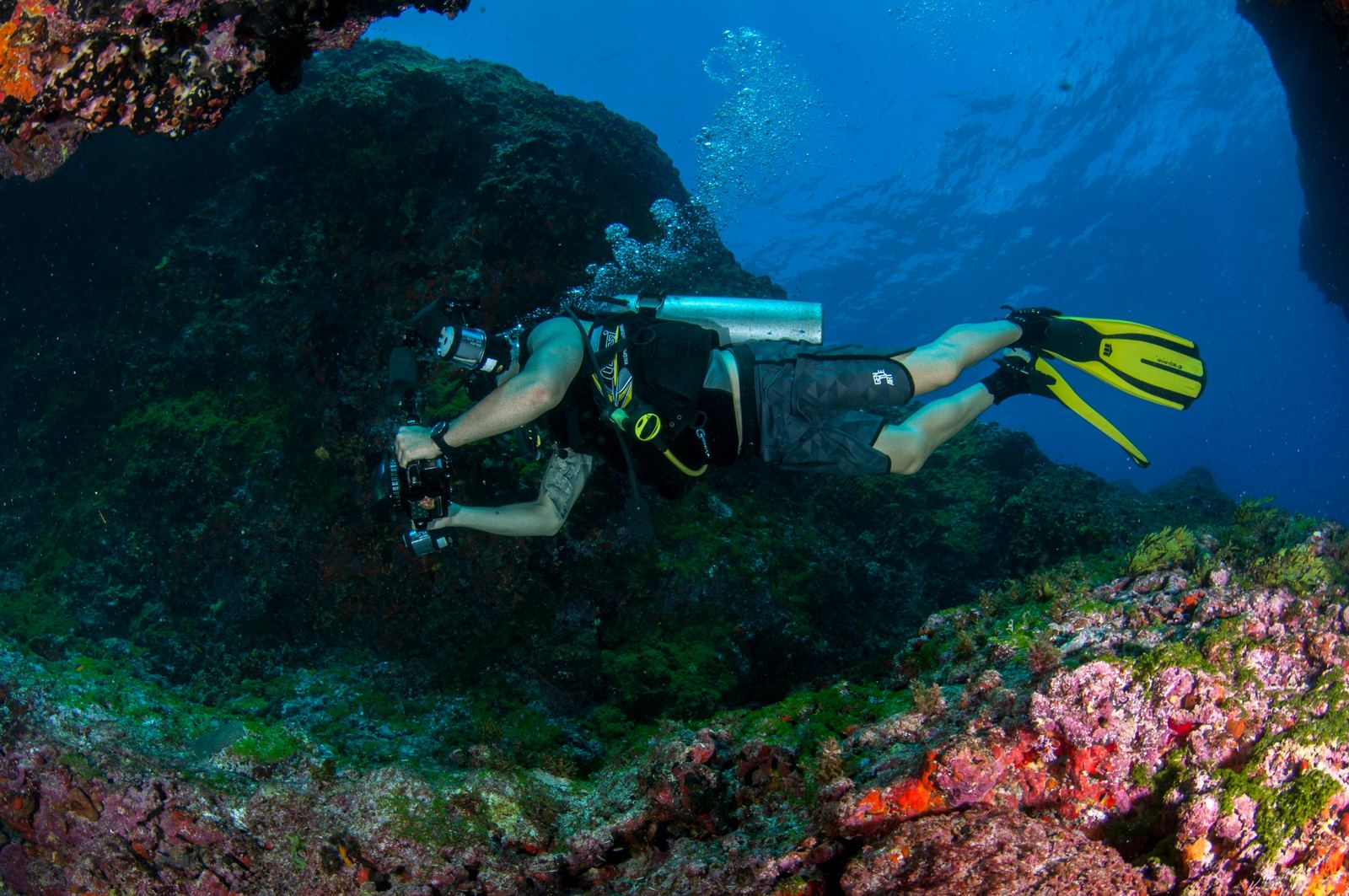
- Touch nothing. Injuring live coral is part of the prohibition. Fin kicks, kneeling on the reef and steadying yourself on coral heads all count as damage, even when they are not deliberate.
- Follow boat rules. At Molokini, commercial operators need a permit, boats use state day-use moorings, and anchoring is prohibited in the mooring area. Rules adopted after a 2023 Land Board review also set a time limit on mooring use and a monthly mooring fee for commercial operators.
Exceptions exist, and they are narrow. Mānele–Hulopoʻe on Lānaʻi allows pole-and-line fishing for finfish and ʻaʻama crab from the shoreline only. Scientific and educational permits allow some activity in several districts. None of the exceptions covers a visitor collecting a souvenir.
District Notes for Divers
Hanauma Bay, Oʻahu
The bay is a City and County of Honolulu nature preserve inside the state MLCD, so both city park rules and state rules apply. Reservations are required for the mandatory orientation, the preserve is closed every Monday and Tuesday to give the bay a rest, and it closes on Christmas and New Year's Day. Commercial scuba is regulated under the city's park rules. For almost every visitor this is a snorkel site.
Pūpūkea, Oʻahu
Shark's Cove and Three Tables are among the best summer shore dives on Oʻahu, and they are inside the Pūpūkea MLCD. Community members watch this reef closely; a 2021 case began when people reported a man taking ʻopihi from the shoreline rocks, and a DOCARE officer cited him for prohibited activities in the district.
Molokini Shoal, Maui
The crater rim and the water around it are split into two subzones. The diving rules for a guest on a dive boat are simple: no touching, no feeding and no collecting. The operator handles permits and moorings. The outer Back Wall is still part of the district.
Kealakekua Bay, Hawaiʻi Island
The district runs from the high-water mark out to a line from Cook Point to Manini Beach Point, divided into Subzone A to the north and Subzone B to the south. The best diving is at Kaʻawaloa Cove, reached only by boat or permitted kayak tour, with depths from about 5 to 120 feet. Spinner dolphins rest in the bay by day; a separate federal rule keeps everyone at least 50 yards from them.
Old Kona Airport and Waiʻaleʻa Bay, Hawaiʻi Island
Both are easy-access shore sites on the Kona and Kohala coasts. Old Kona Airport's rules focus on not altering or removing shells, sand and coral. Waiʻaleʻa Bay, in South Kohala, prohibits taking marine life and carrying in-water devices used to take it.
Why the Districts Matter to Divers
The difference between an MLCD and an unprotected reef a mile away is often visible on the first dive. Larger parrotfish, schools of goatfish and surgeonfish that do not scatter, and fish that let you approach within a few feet are what decades of protection look like. Those fish also do work for the reef: grazing herbivores keep algae from smothering coral, which is why some newer state rules focus specifically on protecting them.
The districts are small and heavily visited. Hanauma Bay's reservations and weekly closures exist because heavy visitor numbers were wearing the reef down. Every diver who keeps off the coral, keeps their hands to themselves and leaves the shells where they lie makes the next diver's visit better.
How to Report a Problem
If you see someone taking marine life, spearfishing or collecting inside an MLCD, do not confront them. DLNR asks the public to report it to its Division of Conservation and Resources Enforcement (DOCARE):
- Call the 24-hour DOCARE hotline at 643-DLNR (643-3567).
- Use the free DLNRTip app, which strips identifying information from tips before officers see them.
- Text the tip number listed on the Division of Aquatic Resources site with your island's keyword.
Note the time, place, a description of the people and any vehicle or boat, and photos if you can take them safely. Injured, stranded or entangled turtles, seals, dolphins and whales go to a different number: the 24-hour statewide marine wildlife hotline, (888) 256-9840, which works from any island. Our marine-life etiquette page covers viewing distances.
A Diver's MLCD Checklist
- Check whether your site is in a district: the Dive Site Finder and our island pages flag every MLCD site.
- Leave spears, slurp guns, collecting bags and fish food out of your dive kit.
- Wear a mineral sunscreen and cover up; see our sunscreen rules.
- Weight yourself properly so you can hover without touching the reef.
- Take photos, not souvenirs, and report what you see that is wrong.
The rules inside an MLCD are short: look, enjoy, leave it all behind.